- EXPERT'S HELP
- +256789210067
- +256200955001
- info@kenlinktours.com


Big five in Rwanda and Gorilla Trek in Uganda
September 17, 2026
Murchison Falls and Rhino Tracking Tour
September 17, 2026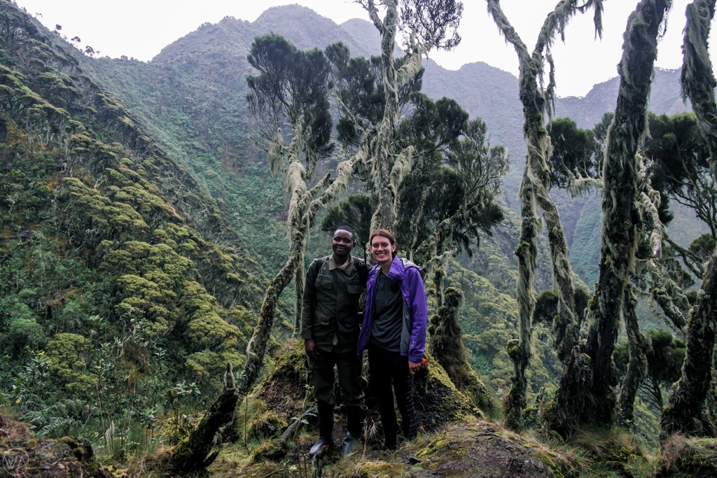
How is Mount Sabyinyo Hiking in Uganda. There is exactly one hike in Africa where a single step can carry you across three international borders, and it happens on the jagged, tooth-shaped summit of Mount Sabyinyo. Rising 3,669 metres above the Virunga volcanic range, Sabyinyo sits precisely where Uganda, Rwanda, and the Democratic Republic of Congo meet, and hikers who reach its highest peak can stand with one foot in each country at once. For travelers already planning a gorilla trekking safari in Uganda, adding a day for this climb turns a wildlife-focused trip into something with genuine adventure-travel credentials.
This guide covers everything you need to plan the hike properly: what the trail actually involves, how much it costs, how difficult it really is, when to go, and how to fit it around gorilla trekking and other activities in southwestern Uganda’s Uganda-Rwanda border region.
What Is Mount Sabyinyo and Why Is It Famous?
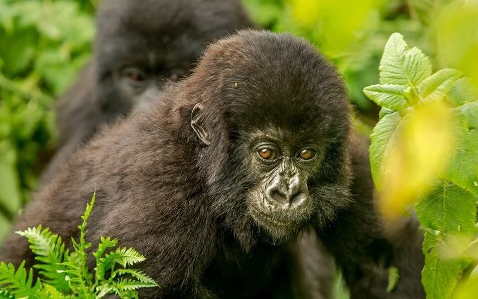
Mount Sabyinyo is an extinct stratovolcano and the oldest peak in the Virunga Mountains chain, a range of eight volcanoes strung along the Uganda-Rwanda-DRC border. Its name comes from the Kinyarwanda word “Iryinyo,” meaning tooth, and the mountain’s serrated, worn-down summit ridge has earned it the local nickname “Old Man’s Teeth.” Unlike most single-summit volcanoes, Sabyinyo actually has three distinct peaks along its ridge, each marking progressively higher ground, with the third and highest peak sitting exactly at the tripoint where the three countries converge. It’s this geographic quirk — reaching a spot where three nations touch at once — that has made Sabyinyo one of East Africa’s most bucket-list-worthy day hikes, alongside its role as prime habitat for the endangered mountain gorilla populations that move freely across its lower slopes.
Where Mount Sabyinyo Sits: Mgahinga Gorilla National Park
On the Uganda side, Mount Sabyinyo forms the backbone of Mgahinga Gorilla National Park, Uganda’s smallest national park and its only Virunga volcano park. Mgahinga borders Volcanoes National Park in Rwanda and Virunga National Park in the DRC, meaning all three of the region’s Sabyinyo trailheads sit within a short driving distance of each other, even though only the Uganda approach is open to hikers year-round. Pick and Transfer Safaris covers this same park in detail in their Mgahinga Gorilla National Park destination guide, which is worth reading alongside this one if you’re weighing Uganda against the Rwandan side of the volcano range.
How Difficult Is the Mount Sabyinyo Hike?
Make no mistake: this is one of the more physically demanding day hikes in East Africa, and it is not recommended for hikers without a reasonable baseline of fitness. The trail climbs steeply through montane forest and bamboo zones before breaking into open Afro-alpine vegetation near the ridge, and the final push to the third peak involves narrow, exposed sections where the ridge drops away sharply on both sides. Altitude adds to the challenge — by the summit you’re above 3,600 metres, high enough that shortness of breath is normal even for fit hikers who haven’t acclimatized. Anyone with a fear of heights should think carefully before attempting the final peak, since the exposed ridge walk between the second and third summits is the most talked-about (and most intimidating) stretch of the entire route.
The Famous Ladders Near the Summit
What makes Sabyinyo passable at all despite its steep, crumbling volcanic rock is a series of handmade wooden ladders that Uganda Wildlife Authority rangers have installed at the trail’s most vertical sections, particularly on the approach to the second and third peaks. These ladders are sturdy and well-maintained, but they are also narrow, sometimes damp, and set against near-vertical rock faces, so a moment of focus is required each time you use one. Guides and rangers who accompany every group are experienced at helping hikers up and down these sections, and most visitors describe the ladder-climbing as the most memorable — if nerve-wracking — part of the entire hike.
How Long Does the Hike Take?
The Mount Sabyinyo hike is a full-day activity, though it does not require an overnight stay on the mountain. Hikers register at the Ntebeko park office inside Mgahinga Gorilla National Park at around 8 a.m. for a briefing with rangers and guides, then set out on the ascent, which typically takes about four hours to reach the highest of the three peaks. The descent takes a further four hours, bringing the round trip to roughly eight hours of active hiking. Because of how demanding the final stretch is, rangers enforce a soft cutoff: hikers who haven’t reached the summit by around 3 p.m. are generally advised to turn back rather than risk descending the ladder sections after dark.
Mount Sabyinyo Hiking Permit Cost
A Mount Sabyinyo hiking permit currently costs around $85 per person, which covers park entrance fees and the mandatory ranger guide and armed escort that accompanies every group. This is separate from, and considerably cheaper than, a gorilla trekking permit, which makes Sabyinyo an appealing add-on activity for travelers who want an adventure day without the cost of a second gorilla trek. If you’re budgeting a longer Mgahinga visit that includes both gorilla trekking and the Sabyinyo hike, our guide on how much a gorilla trekking safari costs in Uganda is a useful companion piece for working out your total trip budget.
Standing in Three Countries: What the Summit Experience Is Really Like
The reward for the climb is genuinely unusual: a small, marked point on the third peak where boundary pillars indicate the meeting point of Uganda, Rwanda, and the Democratic Republic of Congo. On a clear day, the view stretches across the entire Virunga range, taking in neighbouring volcanoes Mgahinga, Muhabura, Gahinga, Bisoke, and — further into Rwanda — the classic cone of Karisimbi. Cloud cover rolls in and out quickly at this altitude, so patience at the summit often pays off with brief windows of dramatic visibility rather than one continuous view. Many hikers describe the tripoint moment itself as surprisingly understated given the buildup — a modest marker rather than any dramatic monument — but the sheer novelty of the geography, combined with the physical effort it took to get there, tends to make it one of the most talked-about moments of an entire Uganda trip.
Best Time of Year to Hike Mount Sabyinyo
Uganda’s two dry seasons, December to February and June to August, offer the firmest trail conditions and the clearest summit views, which matters enormously on a hike where visibility is half the reward. The wetter months, particularly March to May and September to November, turn the volcanic soil slippery and increase the risk of low cloud obscuring the tripoint view entirely, though they also mean fewer other hikers on the trail. Early morning starts are non-negotiable regardless of season, since afternoon cloud buildup around the Virunga peaks is common even in the dry months.
What to Pack for the Sabyinyo Hike
Layering is the key principle, since temperatures swing from warm and humid at the park office to cold and windy on the exposed upper ridge. A waterproof rain jacket is essential regardless of season, along with a warm fleece or sweater for the summit, sturdy waterproof hiking boots with good ankle support, and gardening-style gloves that protect your hands on the ladder sections and any vegetation grabbing lower down the trail. Bring at least two litres of water, high-energy snacks, sunscreen and a hat for the exposed ridge sections, and a daypack that keeps your hands as free as possible for the ladders. A walking stick, often available for hire or free use at the park office, is genuinely useful on both the ascent and the knee-jarring descent.
Fitness and Age Requirements
There’s no strict age limit written into park regulations, but realistically this hike suits fit, active teenagers and adults rather than young children or anyone with significant mobility or cardiac concerns, given the sustained climbing, altitude, and exposed ladder sections. If you’re unsure whether your fitness level is up to it, a good benchmark is whether you can comfortably manage several hours of steady uphill walking at altitude without a specific training regimen — if that sounds achievable, Sabyinyo is within reach with a reasonable pace and the encouragement of your guide.
Weather and Climate on the Mountain
Weather on Sabyinyo shifts fast, and it’s worth planning for all of it in a single day. At the Ntebeko park office, mornings are usually mild and often misty, warming quickly as the sun rises over the bamboo zone. By the time you reach the higher slopes, temperatures drop noticeably, and wind picks up along the exposed ridge connecting the second and third peaks, making the summit feel considerably colder than the trailhead despite being only a few hours’ walk away. Rain can arrive with little warning at any time of year, even in the official dry months, which is exactly why a proper rain jacket sits at the top of every packing list rather than being treated as optional extra weight. Guides generally push for an early start precisely because morning skies are more reliably clear, giving hikers the best odds of a real view once they reach the tripoint.
Combining Mount Sabyinyo with Gorilla Trekking in Mgahinga
Because both activities are based out of the same park office, it’s straightforward to combine a Sabyinyo hike with gorilla trekking during the same visit to Mgahinga, typically on separate consecutive days given how demanding each one is on its own. Our overview of gorilla trekking in Uganda explains how Mgahinga’s single habituated gorilla family compares with the larger, more established sectors of Bwindi, which is useful context if you’re deciding how to split your time between the two parks. Pick and Transfer Safaris’ gorilla safari packages and their shorter 2-day Volcanoes gorilla trek from Kigali are useful references if your route also touches the Rwandan side of the border.
Golden Monkey Tracking: A Lower-Effort Alternative
If the idea of an eight-hour, high-altitude climb with ladder sections sounds like more adventure than you’re after, Mgahinga also offers golden monkey tracking, a far gentler half-day activity through the park’s bamboo forest that still delivers close encounters with a charismatic, endangered primate found only in the Virunga range. It’s a popular choice for travelers who want a taste of Mgahinga’s forest environment without committing to the full Sabyinyo ascent, and it pairs naturally with a relaxed second day spent exploring Kisoro town or resting ahead of a gorilla trek.
Conservation and Community Impact of Hiking Sabyinyo
Every hiking permit fee feeds directly back into Uganda Wildlife Authority’s conservation budget and into revenue-sharing programs with communities living along Mgahinga’s boundary, many of whom depend on tourism income as an alternative to farming the steep, erosion-prone slopes that border the park. Batwa communities, the region’s original forest-dwelling inhabitants, are also part of this picture, and several lodges and operators around Kisoro arrange respectful cultural visits or performances as an optional add-on to a hiking or gorilla trekking itinerary. Choosing a reputable local operator, sticking to marked trails, and tipping guides and porters fairly are simple ways hikers can make sure their visit supports rather than strains this small but ecologically vital patch of the Virunga range.
Is Mgahinga Safe for Hikers and Tourists?
Security around Mgahinga and the broader Kisoro region has been stable for years, with armed ranger escorts accompanying every hiking and trekking group as standard practice, both for wildlife safety and general security. We cover this question in more depth in our article on whether Mgahinga is safe for tourists, which addresses the most common concerns travelers raise about visiting this particular corner of Uganda near two international borders.
Getting to Mgahinga: Routes from Kigali and Entebbe
Most Sabyinyo hikers arrive via one of two routes: a road transfer of roughly four to five hours from Kigali, Rwanda, or a longer road journey (or short domestic flight) from Entebbe, Uganda. Because Mgahinga sits right on the Rwandan border, many travelers doing a combined Rwanda-Uganda trip find it more efficient to fly into Kigali, hike Sabyinyo and trek gorillas in Mgahinga, then continue north into Uganda toward Bwindi or Queen Elizabeth National Park. Our guide on landing in Kigali or Entebbe for a gorilla safari breaks down which entry point makes more sense for your specific itinerary, and if your route continues on to Bwindi, our piece on driving from Bwindi to Mgahinga Gorilla National Park covers that connecting leg in detail. Pick and Transfer Safaris addresses the same cross-border logistics in their article on starting a tour from Kigali Airport and ending in Entebbe Airport.
Where to Stay Near Mgahinga Before Your Hike
Basing yourself near the park the night before is strongly recommended, since the 8 a.m. registration time leaves little margin for a long morning drive. Kisoro town, a short distance from the park gate, has the widest range of accommodation options, from budget guesthouses to comfortable mid-range lodges, and our roundup of accommodation near Mgahinga Gorilla National Park lists the best-located options by budget. Pick and Transfer Safaris’ guide to the Ikoro Hotel in Kisoro is a solid option to check if you’re looking for a specific, well-reviewed property in the same area.
Where to Eat Around Mgahinga and Kisoro
Kisoro’s dining scene is modest but functional, with most lodges offering full-board meal plans that cover breakfast before your hike and dinner after a long day on the mountain. For independent travelers or those with time to explore, our guide on where to eat near Mgahinga Gorilla National Park lists a handful of local spots worth trying, particularly useful if you’re stocking up on snacks and packed lunches the night before an early hiking start.
Choosing a Local Tour Operator in Kisoro
While it’s possible to arrange a Sabyinyo hiking permit directly through Uganda Wildlife Authority, most travelers book through a local operator who can bundle the hike with transport, accommodation, and permit logistics in one package. Our article on tour operators in Kisoro explains what to look for when choosing who to book with in this specific part of southwestern Uganda, where road access and permit timing require more local knowledge than better-known destinations elsewhere in the country.
Visa Requirements for Visiting Uganda
Most international visitors need a visa to enter Uganda, and the process is straightforward through the country’s e-visa portal, which is worth completing at least a few weeks ahead of travel rather than relying on visa-on-arrival at the border. Our step-by-step breakdown of the Uganda tourist visa application process walks through exactly what documents you’ll need and how long approval typically takes, which is especially useful if your itinerary involves entering through Kigali and crossing the land border into Mgahinga.
Other Adventure Activities to Add to Your Southwestern Uganda Trip
Sabyinyo is one of several standout adventure activities clustered in Uganda’s far southwest, alongside gorilla and golden monkey trekking, and travelers with extra time often build a broader adventure itinerary around this corner of the country. Our roundup of Uganda safari experiences covers the wider range of activities available if you want to extend your stay beyond the Mgahinga area, and our Uganda-Rwanda gorilla safaris page shows how Sabyinyo, golden monkeys, and gorilla trekking on both sides of the border can be combined into a single well-paced route. For a Rwanda-side perspective on the same volcano range, Pick and Transfer Safaris’ Volcanoes National Park guide and their broader wildlife safaris collection are useful further reading, alongside their Bwindi Impenetrable Forest guide if Sabyinyo is just one stop on a longer Uganda loop.
Frequently Asked Questions About Hiking Mount Sabyinyo
How hard is the Mount Sabyinyo hike? It’s considered one of the more strenuous day hikes in the region, involving roughly eight hours of round-trip hiking, high altitude, and exposed ladder sections near the summit, so a reasonable level of fitness is important.
How much does the Sabyinyo hiking permit cost? Around $85 per person, which includes park entrance and the mandatory ranger guide, making it considerably cheaper than a gorilla trekking permit.
Can you really stand in three countries at once? Yes — the third and highest peak of Mount Sabyinyo sits directly on the tripoint where Uganda, Rwanda, and the Democratic Republic of Congo meet, marked by boundary pillars at the summit.
Do you need to be an experienced hiker? No technical climbing experience is required, but the ladder sections and sustained uphill effort mean this is not a beginner-friendly stroll; a decent baseline fitness level makes the day far more enjoyable.
Can you combine Sabyinyo with gorilla trekking? Yes, both activities start from the same Ntebeko park office in Mgahinga Gorilla National Park, though most visitors do them on separate days given how physically demanding each one is.
Comparing Sabyinyo to Rwanda’s Bisoke and Karisimbi Volcano Hikes
Mount Sabyinyo isn’t the only Virunga peak that draws hikers to this border region — on the Rwandan side of Volcanoes National Park, Mount Bisoke and Mount Karisimbi offer their own volcano-climbing experiences, each with a very different character. Bisoke is famous for its crater lake at the summit and is roughly comparable in difficulty to Sabyinyo, while Karisimbi, the tallest of the Virunga volcanoes at over 4,500 metres, is a genuine two-day expedition with an overnight camp partway up. Sabyinyo remains the standout choice for hikers specifically drawn to the novelty of the tripoint border crossing, while Bisoke and Karisimbi appeal more to those chasing altitude and crater scenery. If your trip includes time on the Rwandan side, our overview of Rwanda safari holidays touches on how these volcano hikes fit alongside gorilla trekking and Akagera game drives in a broader Rwanda itinerary.
What Your Ranger Guide Does on the Trail
Every Sabyinyo hike is led by a Uganda Wildlife Authority ranger guide, typically accompanied by an armed escort, both of whom are on the mountain daily and know its moods well. Beyond simply setting the pace, your guide manages the ladder crossings, points out wildlife signs and plant life along the lower forest sections, and makes the judgment call on whether weather or trail conditions warrant turning back before the summit. Tipping guides and porters at the end of the day is customary and genuinely appreciated, reflecting both the physical demands of their job and the fact that tourism income from activities like this directly supports communities living around the park boundary.
After the Hike: Where to Relax and What Comes Next
Most hikers are, understandably, ready to do very little the evening after a full day on Sabyinyo’s ladders and ridgelines. Kisoro’s lodges are well set up for exactly this, with hot showers, hearty dinners, and relaxed lake or volcano views making for an easy recovery evening before continuing your trip. Many travelers use Mgahinga as a hinge point between Rwanda and Uganda, either heading south into Rwanda toward Kigali and Volcanoes National Park or continuing north toward Bwindi and Uganda’s savannah parks. Our guide on starting a trip from Rwanda to Uganda is useful if you’re routing this way, and Pick and Transfer Safaris’ article on what to do after a gorilla tour in Bwindi offers further ideas for winding down after a physically intense few days in the parks.
Booking Your Permit and Trip in Advance
Unlike gorilla permits, which are strictly capped and often sell out months ahead during peak season, Sabyinyo hiking permits are somewhat more flexible, though booking in advance is still strongly recommended, particularly if you’re trying to line the hike up with specific gorilla trekking or golden monkey tracking dates at the same park. If you’re piecing together a wider Rwanda-Uganda budget that includes this hike, our breakdown of the cost of safaris in Rwanda is a useful reference point for the Rwandan side of your trip, and Pick and Transfer Safaris’ full list of Rwanda and Uganda destinations is worth browsing if you’re still deciding how much time to allocate to this border region versus the rest of your itinerary.
Plan Your Mount Sabyinyo Hike with Kenlink Tours
Few single-day activities in East Africa combine physical challenge, geographic novelty, and genuine wilderness scenery quite the way Mount Sabyinyo does. Whether you’re adding it onto a gorilla trekking itinerary in Mgahinga or building a broader adventure route through southwestern Uganda, getting the logistics right — permits, timing, accommodation, and transport — makes the difference between a smooth day and a stressful one. Get in touch through our contact page to start planning a Mgahinga itinerary built around your fitness level, travel dates, and what else you want to see on both sides of the Uganda-Rwanda border.